Find Your Property Boundary for £24.95
Official HM Land Registry GPS coordinates for every corner of your property — delivered instantly as a PDF. No surveyor appointment, no waiting weeks, no £1,000 bill.
Search Your Property →See how BoundaryFinder works — from postcode to GPS coordinates in minutes.
The Problem We Solve
Every year, thousands of homeowners in England and Wales face the same frustrating situation. They need to build a fence, sort out a boundary dispute, or simply understand where their property ends — but the survey pegs are nowhere to be found. Buried under years of soil, lost during landscaping, or simply never marked in the first place.
A professional surveyor can help, but they charge £400 to £1,000 or more. And you might wait weeks for an appointment. Meanwhile the fence stays up, the neighbour stays difficult, and the uncertainty continues.
BoundaryFinder was built to solve that problem. For £24.95, you get the registered GPS coordinates for every corner of your property boundary — from official HM Land Registry data — delivered to your inbox in minutes.
How It Works
Enter your postcode, select your property, and receive your GPS Boundary Report instantly by email. The report gives you everything you need to locate and walk your boundary on the ground.
Enter Your Postcode
Search by postcode or address. BoundaryFinder finds your registered title and shows you the boundary on a live map before you pay.
Pay Securely — £24.95
No account required. Pay once via Stripe. No subscription, no monthly fee.
Receive Your Instant PDF Report
Your GPS Boundary Report arrives by email within seconds. GPS coordinates for every boundary corner, satellite and OS maps, and export files for your phone or CAD software.
Walk Your Boundary
Open SW Maps, Google Maps or OsmAnd on your phone. Load your GPX file. Walk to each corner. Know exactly where your boundary is on the ground.
Used by Homeowners Across England & Wales
 Click to enlarge
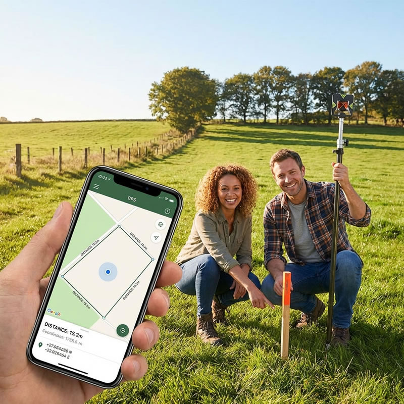
Walking the boundary with a smartphone GPS app — navigate to each corner directly from the report.
 Click to enlarge
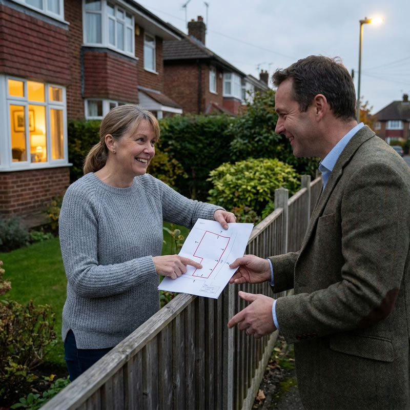
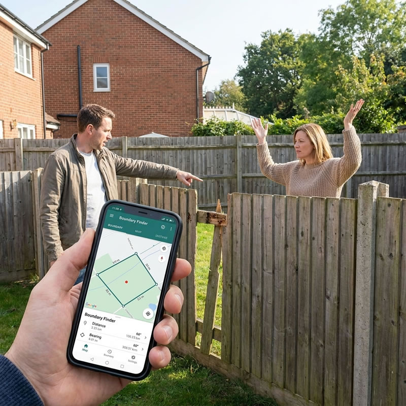
Checking a fence line against the registered boundary — useful before building or during a dispute.
 Click to enlarge
Your GPS Boundary Report on your phone — all boundary corners, coordinates and maps in one PDF.
What’s Included in Every Report
GPS Coordinates for Every Corner
Latitude/longitude and British National Grid Easting/Northing for every boundary corner of your registered title.
Satellite & OS Map Overlays
Your boundary shown on Google satellite imagery and Ordnance Survey maps, with bearing and distance guidance between corners.
Export Files for All Platforms
GPX for SW Maps and OsmAnd, GeoJSON for QGIS, DXF for AutoCAD, CSV for spreadsheets, KMZ for Google Earth.
Terrain & Elevation Report
Ground elevation profile using Environment Agency LiDAR data — useful for drainage, planning and rural boundary work.
HMLR Title Documents (Add-on)
Order your official Title Plan and Title Register directly from HM Land Registry. Add to your report at a discounted bundle price.
Fence & Boundary Guide
Free with every report — a plain-English guide to T-marks, fence ownership, the hedge and ditch rule, and what to do in a dispute.
Our Data Sources
BoundaryFinder only uses official government open data. No estimates, no guesswork.
The official digital boundary data for all 26 million registered titles in England and Wales. Open Government Licence.
Ordnance Survey base mapping for property context and scale reference.
1-metre resolution Digital Terrain Model covering approximately 75% of England. Open Government Licence.
Address-to-coordinate lookup for property search and postcode resolution across England and Wales.
All boundary data is derived from general boundaries under Section 60 of the Land Registration Act 2002. BoundaryFinder reports show the registered approximate boundary position — not a legally determined exact line. Learn more about general boundaries →
Why BoundaryFinder?
- ✓ Results in minutes
- ✓ £24.95 — pay once, no subscription
- ✓ Official HM Land Registry data
- ✓ Works on any smartphone
- ✓ GPS, maps & export files included
- ✓ No appointment needed
- ✓ Authorised HMLR data reseller
- ✗ Wait 2–6 weeks for appointment
- ✗ £400–£1,000+ per survey
- ✗ Uses same HMLR data as starting point
- ✗ Physical site visit required
- ✗ Paper report only
- ✗ Must schedule in advance
- ✗ Necessary for determined boundaries
A RICS surveyor is the right choice when you need a legally determined boundary or expert witness report. BoundaryFinder is the right starting point for everything else.
Know Your Boundary Before You Dig, Build or Dispute
Enter your postcode. Get your GPS boundary coordinates. Walk your boundary today.
Search Your Property — £24.95 →Instant PDF delivery • Official HM Land Registry data • England & Wales only
Walking your boundary with a smartphone GPS app.
Checking a fence line against the registered boundary.
Your GPS Boundary Report on your phone.