Where Is My Property Boundary in Cardiff?
Find the general boundary of your Cardiff property in seconds. Enter your postcode, see the registered general boundary on a satellite map, then navigate every boundary point using GPS on your phone.
Find Your Cardiff Property Boundaries — Then Walk Them
Under Section 60 of the Land Registration Act 2002, almost all registered property boundaries in England & Wales are general boundaries. We help you locate and walk yours.
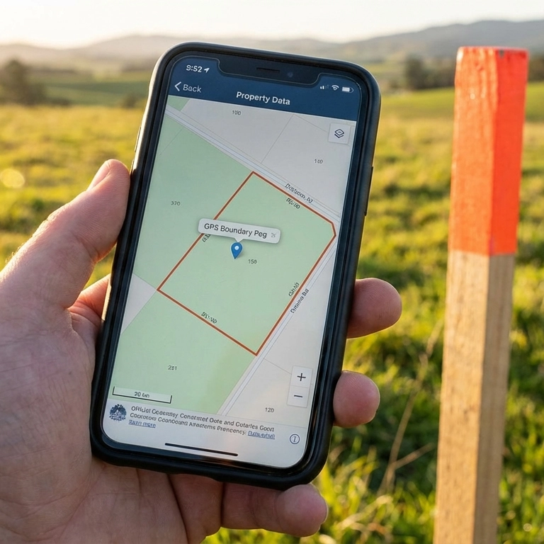
Boundary Map With Distances
Every boundary point mapped with distances between them. See exactly where your Cardiff property starts and ends.

See It on the Ground
Stand at your fence line and see your boundary overlaid in real-time. Know exactly where your property starts and your neighbour’s ends.

Walk Your Entire Perimeter
Follow the GPS from corner to corner around your whole property. Compass bearings and distances guide you every step of the way.
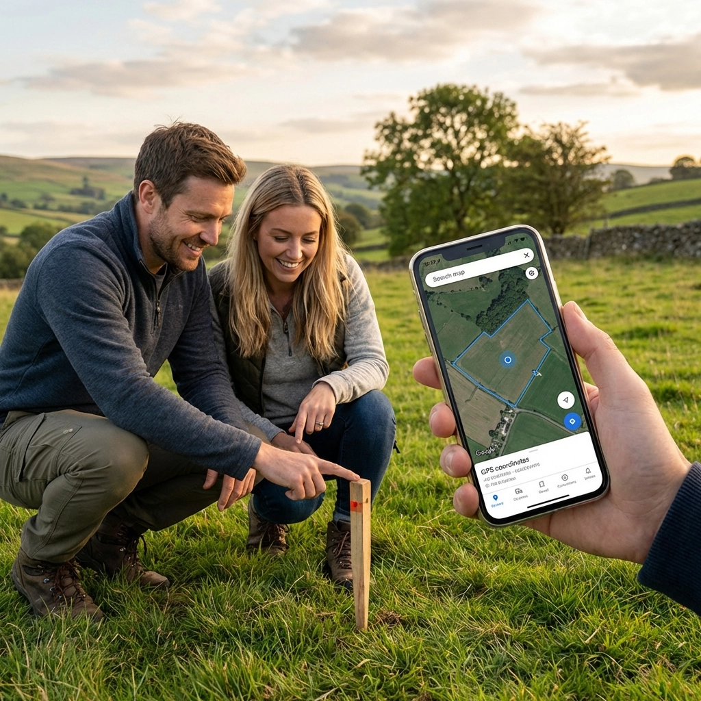
Walk Your Boundaries With Your Phone
Our reports include live mobile GPS navigation that guides you to every boundary corner point. Open the report on your phone and follow the compass bearing and distance to walk your entire property perimeter — point by point.
Why Cardiff Property Boundaries Matter
Victorian Bay Terraces
Cardiff’s bay-fronted terraces in Cathays, Roath and Splott are a defining feature of the city. Narrow plots with rear gardens and shared alleyways make boundary clarity essential for any building or extension work.
Cardiff Bay Regeneration
The transformation of Cardiff Bay from Tiger Bay docks to a modern waterfront has created thousands of new residential plots. Newly registered boundaries on apartments and townhouses need GPS-level precision.
Suburban Family Homes
Popular suburbs like Whitchurch, Llandaff, Rhiwbina and Cyncoed feature detached and semi-detached homes with generous gardens. Fence and hedge lines often diverge from the registered boundary over time.
Valleys & Semi-Rural Plots
The Cardiff boundary extends north towards the valleys — Tongwynlais, Radyr and the Taff corridor. Properties here blend urban and rural character with irregular boundaries that benefit from GPS coordinates on the ground.
The General Boundary Rule
Under Section 60 of the Land Registration Act 2002, every registered title plan in England and Wales shows a general boundary only — not the exact legal line on the ground. At 1:1,250 scale, a single millimetre of ink on a title plan can represent over a foot on the ground. This applies to almost every registered property in the country.
BoundaryFinder GPS coordinates are derived from the official HMLR INSPIRE Index Polygons — the same cadastral dataset underlying every title plan. They show the approximate registered boundary position, which is useful for walking the general boundary extent and locating physical features such as fences, hedges and walls. They do not constitute a legal survey or a determined boundary. For any legally binding boundary question, obtain the official HMLR Title Plan and Title Register alongside this report.
Read the full General Boundaries guide ›Understanding Your Property Boundary
T-Marks & Fence Ownership
How T-marks in your title plan determine which fence is legally yours — and who must maintain it.
Fence Disputes Guide
97% of fence disputes are resolved without court. Step-by-step from direct conversation to the First-tier Tribunal.
General Boundaries Explained
Why your title plan shows a general boundary only — and what that means when fence positions are disputed.
Title Plan & Title Register
Download your official HM Land Registry title documents — the primary legal evidence for any boundary question.
Areas We Cover in Cardiff
Our reports cover every registered property in Cardiff and the surrounding South Wales area. Search by postcode for instant results.
Find Property Boundaries in Cardiff Now
Search any address or postcode in Cardiff and South Wales. Hundreds of thousands of registered properties covered.
GPS Boundary Points Report

Sample Boundary Report
