GPS Boundary Report & HMLR Land Registry Information
Find your exact registered boundary corners with GPS coordinates, and get guidance on where to obtain the official HMLR title documents you need.
Enter your postcode below for GPS coordinates to every registered boundary corner. England & Wales.
Title Documents — Coming Soon on BoundaryFinder
Official Copy of Title Register & Title Plan — HMLR Land Registry
We don’t currently sell title documents directly. Order an Official Copy of the Title Register — £7 or an Official Copy of the Title Plan — £7 from HM Land Registry. These are the primary legal documents for any boundary or ownership question — court-admissible under s.67 LRA 2002.
How to Establish Your Property Boundary
GPS evidence first, then legal documents, then on-the-ground inspection.
Order Your GPS Boundary Report
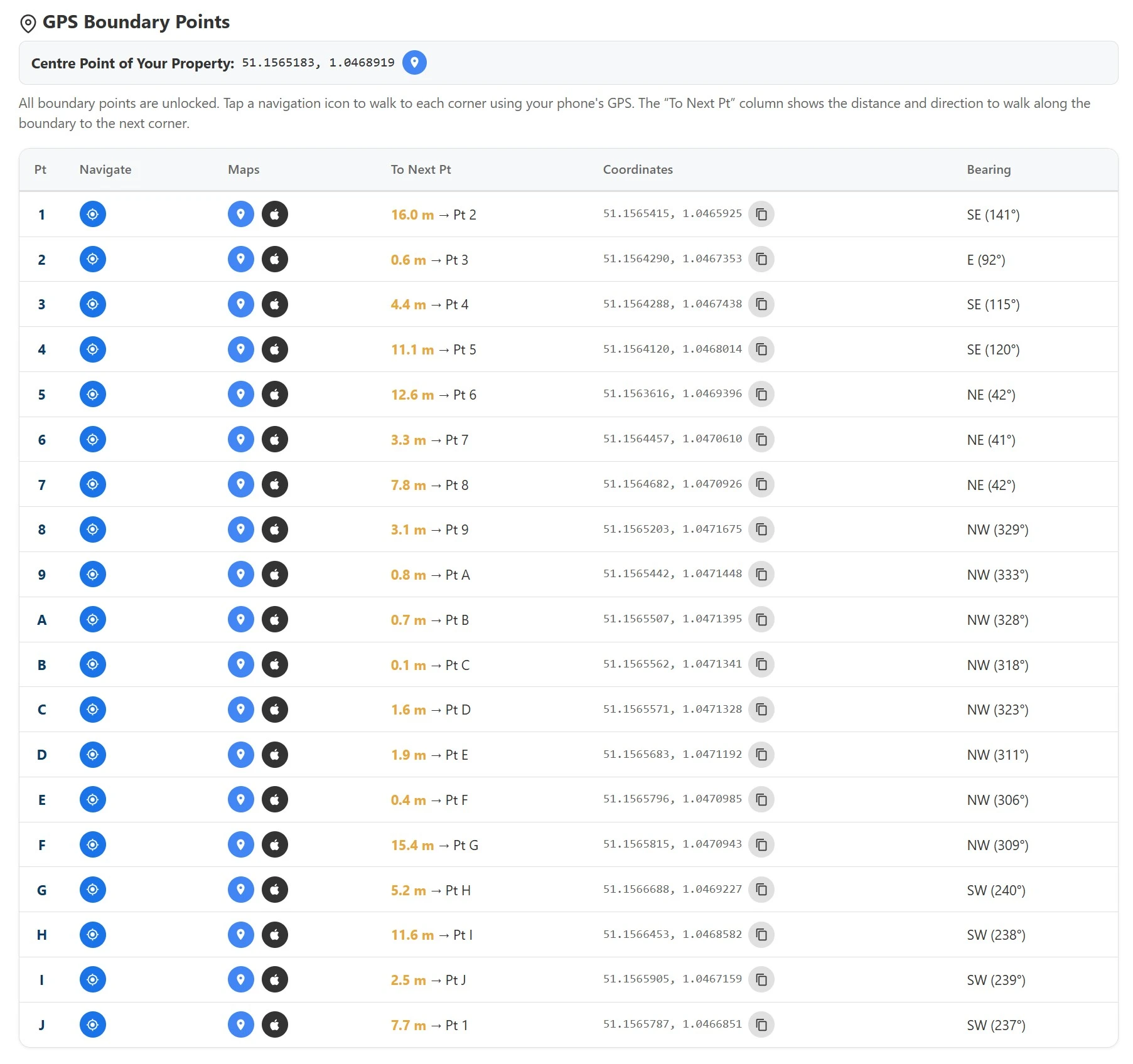
Every registered boundary corner from the HMLR INSPIRE dataset plotted to GPS coordinates. Walk the line with your smartphone and see exactly where the registered boundary sits on the ground — essential context before reading title documents.
Enter Postcode & Order — £24.95 →📄 Fence & boundary guide included
Buy Title Register & Title Plan at GOV.UK
The HMLR Title Register shows ownership, covenants and any fence maintenance obligations. The Land Registry Title Plan shows your property boundary edged in red with T-marks. Official Copy of each — £7, admissible in court under s.67 LRA 2002.
Buy Title Register & Title Plan at Gov.uk →Understand Your Boundary in Law
Read our free guides on the General Boundaries Rule, fence conventions, fence ownership and fence disputes — essential reading before, during or after any boundary question.
General Boundaries Rule →Your GPS Boundary Report
Instant PDF delivered to your email. Built from the official INSPIRE Cadastral dataset — the same source used by HM Land Registry.
- GPS coordinates for every boundary corner (lat/lng + British National Grid)
- Satellite boundary map with registered boundary overlay
- QR code navigation — walk to each corner with your smartphone
- Total land area in m² and hectares
- Full boundary perimeter measurement
- Elevation profile from EA LiDAR data (75% England coverage)
- Building footprint and site coverage percentage
£24.95 — instant PDF delivery
Free Boundary & Title Document Guides
Everything you need to understand title documents, boundary law, and fence ownership in England & Wales.
Which Fence Is Mine?
T-marks on the Title Plan show which fence belongs to you and who must maintain it. Step-by-step guide to finding out who owns the fence in England & Wales.
Read the guide ›Fence Ownership Guide
T-marks, H-marks, and the covenant wording in the Title Register — the complete legal guide to fence ownership when title documents are involved.
Read the guide ›General Boundaries Rule
The red edging on your Title Plan is a general boundary only under s.60 LRA 2002 — not the exact legal line. Understand what the Title Plan can and cannot prove.
Read the guide ›Fence Disputes Guide
97% of boundary disputes are resolved without court. From direct conversation to mediation to the First-tier Tribunal — how title documents fit into each stage.
Read the guide ›Fencing Conventions
Post orientation, closeboard face direction, and the hedge and ditch rule — physical evidence that indicates ownership when title documents are silent.
Read the guide ›Historical Map Compare
Compare your registered boundary against Victorian 1880s Ordnance Survey maps. Useful evidence where a fence has moved since the original conveyance deed.
Explore the map ›Order Your GPS Boundary Report Now
Get GPS coordinates for every registered boundary corner for any of the 26 million registered properties in England & Wales — delivered instantly as PDF. For Official Title Documents, order at GOV.UK for £7 each.
Sample Boundary Report

GPS Boundary Report
Official Copy of Title Plan & Boundary Map
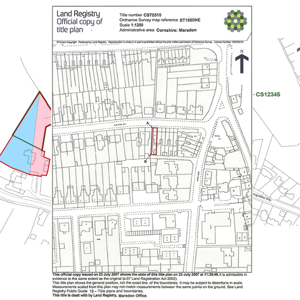
Official Copy of Title Register & Ownership
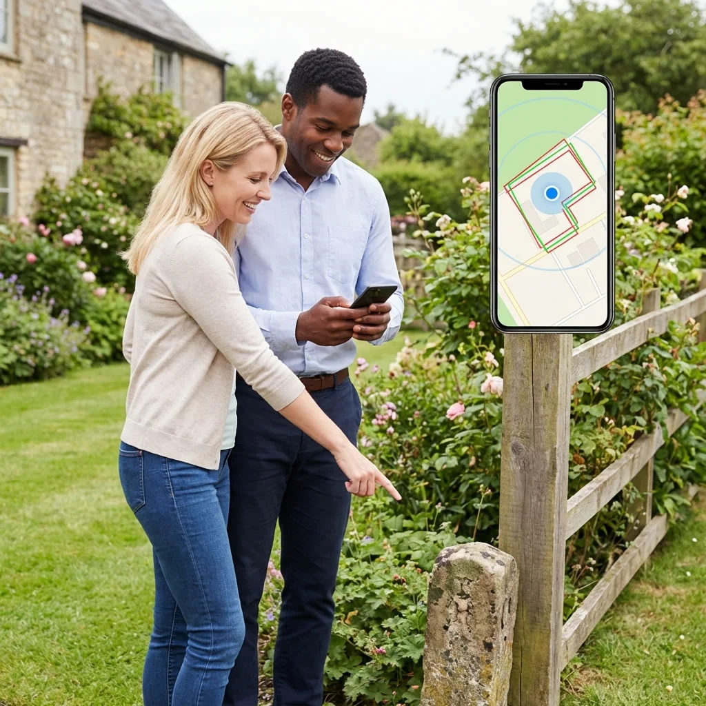
Walk Your Boundaries with GPS
Find Your Boundaries