
Free RINEX Post-Processing for UK Surveyors
OS Net, PPK and No Subscription Fees
Use free data from Ordnance Survey’s OS Net network and open-source software to improve the accuracy of your GPS boundary survey to centimetre level — no paid RTK subscription required.
What is RINEX and Why Is It Free?
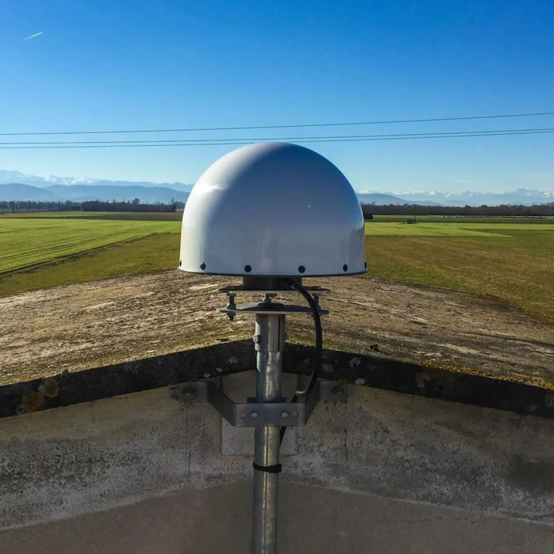
An OS Net reference station — one of around 110 permanently fixed GNSS receivers across Great Britain that continuously log raw satellite data.
RINEX (Receiver Independent Exchange Format) is the standard file format for raw GNSS satellite observations. When your GNSS rover records signals from GPS, Galileo, GLONASS and other satellites, the raw measurements — distances to each satellite, carrier phase readings, timing data — can be stored in RINEX format.
Ordnance Survey operates a network of around 110 permanently fixed GNSS receivers across Great Britain called OS Net. These stations continuously log raw RINEX data and make it available for free download via the OS Data Hub. Because each station’s exact position has been determined to millimetre accuracy, its RINEX data can be used as a trusted base station for any survey in the area.
Why does Ordnance Survey publish it for free?
- Open data policy — OS follows an open-data model for reference station observations, supporting research, education and commercial applications
- Post-processing flexibility — not everyone has real-time internet coverage in the field; RINEX makes high accuracy achievable offline
- Scientific uses — researchers, universities and meteorologists use it for ionosphere modelling, ground subsidence monitoring and timing work
- Verification and quality control — surveyors can re-process completed jobs using the archived data
OS Net RINEX is the free alternative to a paid RTK subscription service. Instead of paying a monthly fee for live corrections, you collect your raw data in the field and download the matching OS Net file afterwards — at no cost.
RTCM vs RINEX — When to Use Which
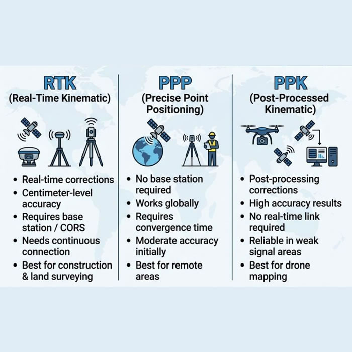
RTCM streams corrections in real time via NTRIP; RINEX is downloaded after the survey and processed on your computer.
RTCM (Radio Technical Commission for Maritime Services) is the format used for real-time corrections. These are streamed live to your rover via the internet using a protocol called NTRIP — typically from OS Net or a commercial provider. You see corrected centimetre-level positions immediately in the field.
RINEX with PPK (Post-Processed Kinematic) takes a different approach: you log raw data during the survey, then download matching base station RINEX afterwards and re-process everything on your computer.
rtk2go is a free, community-run NTRIP caster that our GNSS connect page supports — it costs nothing and gives you a corrected position immediately in the field, no post-processing required. It's a good first thing to try. The trade-off is that it's a best-effort volunteer service: nearby base stations aren't guaranteed to be online, and it still depends on a stable mobile data connection at your property. If it doesn't hold a reliable Fixed solution — or your signal is patchy — PPK below is the free fallback that needs no live connection at all.
Both methods routinely achieve 1–3 cm horizontal accuracy under good conditions. The choice depends on your situation:
| Situation | Use | Why |
|---|---|---|
| Need positions right now (staking, machine control) | Real-time RTCM / NTRIP | Instant feedback |
| Remote area, no mobile signal | Post-processing (RINEX) | No connection needed |
| No paid subscription budget | Post-processing (RINEX) | OS Net is free |
| Urban canyons or tree cover | Post-processing (RINEX) | Forward/backward smoothing helps |
| Drone / aerial survey | Post-processing (RINEX) | No live link to drone needed |
| Final deliverables / legal accuracy | Often both | Real-time in field + PPK for official coordinates |
The Free Workflow — Step by Step
This is the complete workflow from field to corrected coordinates using only free tools and data. It works with any low-cost rover that can log raw GNSS data — including the DATAGNSS Nano used with SW Maps.
-
1
Enable raw data logging on your rover
In SW Maps, go to GNSS Settings and enable raw data logging in UBX format. Set the logging interval to 1 second (1 Hz). Start logging a few minutes before your survey begins and keep it running a few minutes after — the overlap helps the processing software initialise.
You can still connect to a live NTRIP/RTK server at the same time. The app records both real-time corrected positions and the raw UBX data simultaneously.
Check your receiver type matches your actual chipset. SW Maps' “u-blox” option only enables raw logging on genuine u-blox chips. Some budget receivers — including the DATAGNSS Nano Helix RTK, built on the D10P module (Allystar Cynosure IV chipset) — are not u-blox and need their own matching receiver-type entry (e.g. Allystar) in SW Maps' GNSS settings instead. If you only get a plain
.logfile rather than raw UBX, this mismatch is the most likely cause — see the troubleshooting FAQ below for fallback options. -
2
Complete your survey and note the time window
Carry out your survey as normal. Note the approximate start and end times (or use the file timestamps). You will need these to download the matching OS Net RINEX file.
-
3
Download the matching OS Net RINEX file
Go to the OS Data Hub RINEX page (free account required). Select the OS Net station nearest to your survey area (ideally within 20–50 km), choose your date and time window, and download the RINEX observation file (
.rnxor.obs).Files are typically available in hourly chunks. Data is retained for at least 45 days; longer archives are available via the BIGF archive at the University of Nottingham.
-
4
Load both files into Emlid Studio (or RTKLIB)
Open Emlid Studio and go to the PPK tab. Load your rover’s UBX file as the Rover input and the OS Net RINEX file as the Base input. Emlid Studio will convert the UBX to RINEX automatically if needed. Set the correct antenna height for your rover setup.
For RTKLIB: use RTKCONV to convert the UBX file to RINEX first, then use RTKPOST with the same inputs.
-
5
Run PPK and export your corrected coordinates
Click Process. The software resolves carrier phase ambiguities and applies forward and backward smoothing to your data. The output is a new, corrected coordinate file in your choice of format — CSV, KML, GeoJSON or POS. Import this into QGIS, Google Earth, SW Maps or any GIS tool to view your corrected survey on a map.
Free Tools: Emlid Studio vs RTKLIB
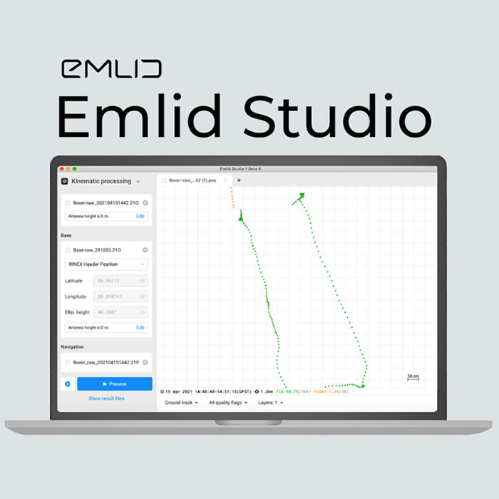
Emlid Studio’s PPK interface — drag in your rover UBX file and OS Net RINEX file, then click Process.
Two free tools cover the needs of most UK surveyors at every skill level:
Emlid Studio
- Handles UBX files directly — no manual conversion step
- Drag-and-drop rover + base workflow
- Built-in drone photo geotagging
- Works with any brand of GNSS receiver, not just Emlid hardware
- Good visual output and quality plots
RTKLIB
- Industry-standard free GNSS software since 2009
- Supports RTK, PPK, static, PPP and more
- Use RTKCONV (UBX → RINEX) then RTKPOST (processing)
- Very detailed quality statistics and RTKPLOT visualisation
- Steeper learning curve — better for advanced users
Start with Emlid Studio — you will get good results quickly with less frustration. Switch to RTKLIB if you need batch processing, Precise Point Positioning (PPP), or more detailed control over processing parameters.
Getting OS Net RINEX Data — Free via the OS Data Hub

The OS Data Hub RINEX page — select a station near your survey area, choose your date and time window, and download for free.
The OS Data Hub RINEX service gives free access to raw observation files from around 110 OS Net stations covering all of Great Britain.
How to download
- Create a free account at osdatahub.os.uk
- Go to Downloads → Open Data → RINEX
- Use the map to find the OS Net station nearest to your survey area
- Select the date and the one-hour block (or multiple blocks) covering your survey time
- Download — files are typically 5–15 MB compressed per hour
Which station to choose
Select the OS Net station closest to your survey area. For most UK locations, there will be a station within 20–40 km. Accuracy is best within 50 km; beyond 100 km the baseline becomes longer and results can degrade slightly, though network processing modes in RTKLIB can extend this range.
Standard OS Data Hub files are available for approximately 45 days. For surveys older than 45 days, use the BIGF archive at the University of Nottingham which maintains a long-term archive of OS Net data.
No Internet Needed in the Field
One of the most practical advantages of the PPK / RINEX approach — especially for rural boundary surveys in England and Wales — is that you do not need a mobile data connection at all during the survey.
In the field: Simply connect your rover (e.g. DATAGNSS Nano) to SW Maps via Bluetooth, enable raw UBX logging, and carry out your survey. No NTRIP server, no Wi-Fi, no mobile signal required.
Later, at home: Download the matching OS Net RINEX file from the OS Data Hub, load both files into Emlid Studio, and process to get centimetre-level corrected coordinates.
This makes RINEX post-processing ideal for:
- Rural properties with poor mobile coverage
- Woodland surveys where signal is intermittent
- Hobbyist or semi-retired surveyors who want to keep costs to zero
- Anyone who collected raw data but did not have a live RTK connection at the time
What Files Do You Get After Processing?
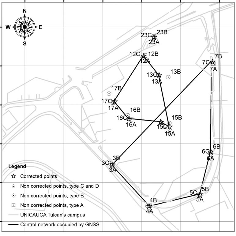
Corrected GPS survey points displayed in QGIS after PPK post-processing — ready for mapping, reporting or further GIS analysis.
After running PPK in Emlid Studio or RTKLIB you will have one or more output files containing your corrected coordinates. Common formats include:
Easting, Northing, Latitude, Longitude — open in Excel, Google Sheets, QGIS or ArcGIS
Load directly into Google Earth or import into SW Maps or OsmAnd
Import into QGIS, ArcGIS or any web mapping platform for spatial analysis
Native RTKLIB format with full quality statistics and fix status per epoch
For AutoCAD, SketchUp and other design tools (via QGIS export)
Standard GIS vector format compatible with most spatial software
These outputs can be loaded back into SW Maps, OsmAnd or any GIS platform to view your corrected survey on a map. They are also compatible with the .dxf, .geojson and .csv export files available for BoundaryFinder GPS boundary reports.
Frequently Asked Questions
.log file rather than raw UBX, see the troubleshooting note below.NANO_RTK_xxxx, password datagnss) and browse to 192.168.4.1 — to check its GNSS and output settings directly, bypassing SW Maps’ chipset detection entirely; or, on a laptop, pair the receiver as a Bluetooth serial port and use RTKLIB’s STRSVR tool to log the incoming raw stream directly to a file, regardless of chipset. Contacting your receiver’s manufacturer for the exact raw-logging method for your model is the most reliable route if these don’t work.Get Your GPS Boundary Points to Post-Process
BoundaryFinder gives you the registered general boundary corner coordinates for your property — ready to export as GPX for SW Maps, GeoJSON for QGIS, DXF for AutoCAD, or CSV for any mapping software. All compatible with the PPK post-processing workflow described on this page.
Search Your Property →Related guides: BoundaryFinder for Surveyors · DataGNSS NANO RTK Guide · Buy a GNSS Receiver · How UK Boundaries Are Measured · General Boundaries Explained
OS Net reference station — one of ~110 across Great Britain.
RTCM real-time corrections vs RINEX post-processing (PPK).
Emlid Studio PPK interface — load rover + base, click Process.
OS Data Hub — selecting a station and time window for free RINEX download.
Corrected GPS points displayed in QGIS after PPK processing.