
Find a RICS Surveyor
Qualified Experts for Fence & Boundary Disputes — England & Wales
Most fence and boundary disputes don't need a surveyor to get started — check your registered general boundary and order your HM Land Registry documents first. It's faster and cheaper than an initial consultation, and it gives any RICS surveyor you do instruct a head start on your case.
GPS Boundary Report — £24.95, delivered as an instant PDF
Before calling a RICS surveyor, review your boundary first
Under Section 60 of the Land Registration Act 2002, almost all registered property boundaries in England & Wales are general boundaries — not a fixed legal line. We help you locate and walk yours.
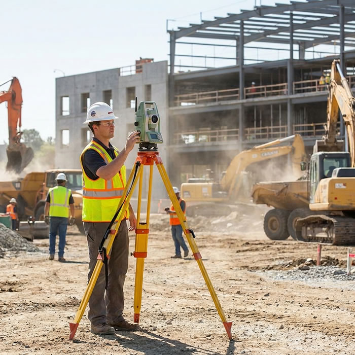
Centimetre-Accurate GNSS & RTK Verification
RICS surveyors use GNSS RTK equipment on site to verify a boundary to survey-grade accuracy. Our data loads directly into their equipment, so a professional opinion can start from the registered position straight away.
Check Your Boundary First →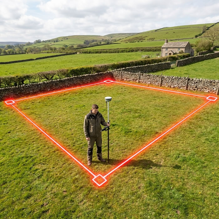
On-Site Boundary Fieldwork
A RICS surveyor can bring our boundary corner data straight into their own field mapping software, walking to every registered point with you before reaching a professional judgement.
Check Your Boundary First →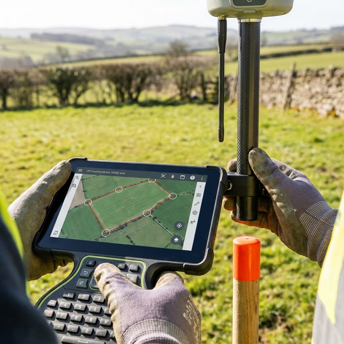
Detailed Plan & Report Review
Behind the scenes, RICS surveyors work with CAD and GIS software to prepare drawings and expert reports. Our data drops straight into these tools, so more of their time goes into your specific boundary issue.
Check Your Boundary First →Already ordered your boundary report and still need a RICS surveyor?
When Do You Need a RICS Surveyor?
If a fence or boundary dispute can't be settled by talking to your neighbour, it's time to bring in a RICS surveyor. Unlike a general practice or building surveyor, a RICS surveyor working in this field specialises in boundary identification, historical deed research and expert witness reports — the independent evidence you need to resolve a dispute or support a tribunal case.
1. Talk to Your Neighbour First

A typical party boundary between two properties — the starting point for most neighbour disputes over fences and land.
Instructing a surveyor without first attempting dialogue often escalates a dispute that could have been resolved amicably. Courts and tribunals expect parties to have attempted resolution before formal proceedings — evidence of good-faith attempts to negotiate is viewed favourably.
If direct communication has failed, or if the dispute involves a significant area of land, a legal threat, or damage to property, then professional advice is the right next step.
Most boundary and fence disputes can be resolved without professional fees. Before spending £800–£4,000 on a surveyor, try these steps:
- Understand general boundaries — under Section 60 of the Land Registration Act 2002, all registered title plans show a general boundary only, not the exact legal line. Your neighbour may not realise this either — sharing this information often defuses disputes instantly.
- Check your title documents — look at your title register and title plan from HM Land Registry (available for £3 at gov.uk). Check for T-marks indicating who owns which fence.
- Walk the boundary together — compare the title plan against features on the ground. Many disputes are based on misunderstanding of where the boundary sits.
- Write a friendly letter — put your understanding in writing calmly. This creates a record and often prompts a constructive response.
Keep the conversation going throughout, even once a surveyor is involved. Staying on speaking terms with your neighbour makes it possible to jointly instruct one shared surveyor instead of two competing ones — cheaper, faster, and far less adversarial. See Section 5 for why this is also what courts expect to see.
2. When You Need a Professional RICS Surveyor
Certain situations clearly warrant professional involvement from the outset:
If your neighbour has instructed a solicitor or threatened legal action, instruct a surveyor immediately to establish your position before any correspondence.
If you intend to build near a boundary — wall, extension, outbuilding — a surveyor can confirm the exact position before work begins and prevent a costly dispute mid-build.
Courts have confirmed that general boundary uncertainty can affect large areas. If more than a strip of land is in question, professional evidence is essential.
An unresolved boundary dispute must be disclosed to buyers. Resolving it with a formal boundary agreement or determined boundary application before sale protects the transaction.
Encroaching tree roots, overhanging branches, or structures built across a boundary require precise survey evidence to support any legal remedy.
Applying to HMLR to fix the exact boundary line (Form DB) under Section 60(3) LRA 2002 requires a surveyor-prepared plan to a high standard of accuracy.
3. What a RICS Surveyor Does

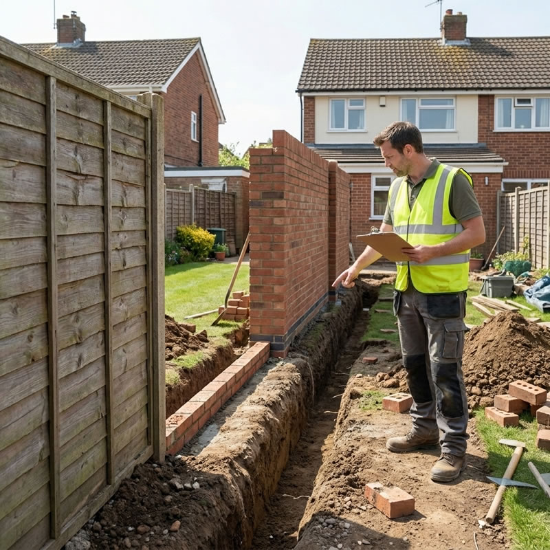
A boundary surveyor physically inspects the site, measures features against title documents, and forms an expert professional opinion on the boundary position.
A boundary surveyor provides a professional service that goes far beyond what any map or title plan can show on its own. Their work typically involves:
Physical Site Survey
The surveyor visits the property and neighbouring land to physically measure the positions of existing features — fences, walls, hedges, ditches, and other boundary markers — using precision instruments (see Section 6). These measurements are tied to the OS National Grid so they can be directly compared with title plan data.
Historical Deed and Document Research
Most boundary disputes turn on what the original conveyance documents intended. The surveyor researches:
- The original conveyance or transfer deed (which created the separate titles)
- Attached plans — scale, orientation, and draughting conventions
- T-marks, H-marks, and other boundary ownership symbols
- Historical OS maps, tithe maps, estate plans, and aerial photographs
- Planning records showing original plot layouts
Expert Professional Opinion
Drawing on the physical survey and documentary research, the surveyor forms an expert opinion on where the boundary was intended to be and where it currently sits on the ground. This opinion is recorded in a formal written report.
Written Expert Report
For dispute cases, the surveyor produces a formal expert report compliant with Part 35 of the Civil Procedure Rules (CPR). This report can be submitted as evidence in mediation, the RICS Boundary Disputes Mediation Service (BDMS), the First-tier Tribunal (Property Chamber), the Upper Tribunal, or the County Court.
4. RICS Qualifications Explained

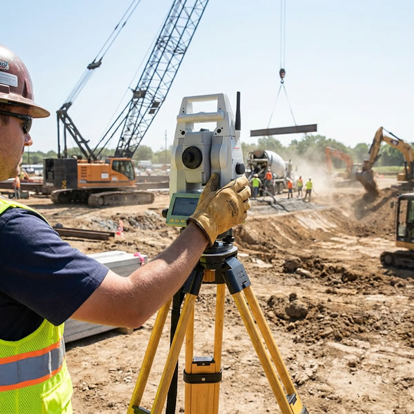
A theodolite on a tripod — traditional precision survey equipment used by chartered surveyors for boundary determination work.
When instructing a surveyor for a boundary matter, qualifications matter significantly. The recognised standards are:
| Designation | Full Title | What It Means |
|---|---|---|
| MRICS | Member of the Royal Institution of Chartered Surveyors | Has passed the RICS Assessment of Professional Competence (APC). Qualified to practice independently. This is the standard minimum for boundary survey work. |
| FRICS | Fellow of the Royal Institution of Chartered Surveyors | Senior designation — awarded for significant contribution to the profession. Indicates extensive experience. Many expert witnesses hold FRICS. |
| AssocRICS | Associate Member | Entry-level qualification. Suitable for standard surveys but not for complex boundary disputes requiring expert witness work. |
Specific Boundary Dispute Experience
Beyond the core RICS designation, look for surveyors who:
- Have specific experience in boundary identification and expert witness work
- Are familiar with Part 35 CPR requirements for expert reports
- Have experience of First-tier Tribunal (Property Chamber) proceedings
- Are listed on the RICS Boundary Disputes Panel (where applicable)
- Have experience of the RICS Boundary Disputes Mediation Service (BDMS)
Always ask a prospective surveyor: "Have you prepared Part 35 expert reports for boundary disputes?" and "Have you given evidence at the First-tier Tribunal?" — the answers tell you whether they have the specific experience your case may need.
5. Can a RICS Surveyor Represent You in Court or Tribunal?
This is one of the most common questions — and the distinction matters:
- Act as an expert witness — providing an independent professional opinion on the boundary position to the tribunal or court
- Prepare and submit a Part 35 CPR expert report as evidence
- Attend the First-tier Tribunal (Property Chamber) to give oral expert evidence and be cross-examined
- Act as a jointly appointed expert — a single surveyor instructed by both parties to provide an independent report (often the most cost-effective route)
- Act as a party-appointed expert — instructed by one party, while owing their duty to the court
- Prepare a Scott Schedule setting out areas of agreement and disagreement with the opposing expert
- Act as your legal advocate — arguing your case, making legal submissions, or cross-examining witnesses on your behalf
- Provide legal advice on your rights or remedies — that requires a solicitor
- Make tactical decisions about the litigation — costs, settlement strategy, witness evidence
Court and tribunal expert evidence belongs to a named person, not their firm. Whoever signs the Part 35 CPR declaration and gives evidence must be the same individual who personally inspected the site, took the measurements, and formed the professional opinion — it cannot be handed off to or signed off by a colleague. When instructing a surveyor for a case that may reach court or tribunal, confirm upfront that the specific person visiting your property also holds RICS Expert Witness accreditation and will be the one presenting the report.
Under CPR 35.7, the courts and the First-tier Tribunal can direct that boundary evidence be given by a single joint expert instructed and paid for by both neighbours together, rather than each side bringing their own. Judges favour this route for two reasons: it halves the cost, and it avoids two conflicting expert reports over what is often a narrow strip of land — a poor use of limited court time. Proposing a shared surveyor to your neighbour early, ideally in writing, is usually the fastest and cheapest way to reach a resolution, and shows the court you tried to resolve things yourselves first.
Who Represents You at Tribunal?
At the First-tier Tribunal (Property Chamber) — the most common forum for boundary disputes in England and Wales — you have several options:
- Represent yourself (as a litigant in person) — permitted and common for straightforward cases
- Instruct a solicitor — recommended where the case is complex or significant sums are at stake
- Instruct a barrister directly (via direct access) — cost-effective for the hearing itself
The surveyor sits alongside your legal representative and gives expert evidence when called — they are not your advocate.
Before tribunal, consider the RICS BDMS — a formal mediation service where a neutral RICS-accredited mediator helps both parties reach a voluntary agreement. Much faster and cheaper than tribunal. No binding outcome unless both parties agree. Search for BDMS mediators at ricsfirms.com.
6. Survey Tools & Technology

A GNSS RTK receiver ties boundary measurements to the OS National Grid with centimetre accuracy — the same technology used in professional boundary surveys.
Professional boundary surveyors use precision instruments to tie measurements to the Ordnance Survey National Grid (OSGB36) — so their survey coordinates can be directly compared with title plan data, historical maps, and OS base mapping.
Total Station (Theodolite + EDM)
The traditional instrument of choice for boundary surveys. A total station measures horizontal and vertical angles and distances from a fixed known point, producing highly accurate XYZ coordinates of every measured feature. It works in any weather, does not depend on satellite signals, and is the standard instrument for legally submitted survey evidence.
GNSS RTK Receivers
GNSS RTK (Real-Time Kinematic) receivers use satellite signals corrected in real time by a reference station network (such as Ordnance Survey's OS Net) to achieve centimetre-level accuracy in the field. RTK is faster than total station work for open-air surveys and is increasingly used alongside traditional methods.
BoundaryFinder's GPS Boundary Report exports your registered boundary polygon vertices in both WGS84 lat/lng and British National Grid (BNG) easting/northing format — the exact coordinate formats used by professional surveyors. A surveyor can import these directly into their survey software as a reference baseline before visiting site.
From the property search page, you can export your boundary polygon as a GPX file compatible with GNSS devices. Your GPS Boundary Report includes the registered boundary position in BNG easting/northing — coordinates any RICS surveyor will immediately recognise. This can save time at the initial consultation stage. Learn about GNSS receivers used for boundary surveys →
7. Typical Costs
Surveyor fees vary considerably by location, complexity, and the amount of historical research required. The figures below are indicative for England and Wales in 2025–2026:
| Service | Typical Cost Range | Notes |
|---|---|---|
| Initial site visit & verbal opinion | £300–£600 | Useful to establish whether a case exists before committing to a full report |
| Boundary survey & written report | £800–£2,500 | Depends on complexity, size, and amount of historical deed research |
| Part 35 CPR expert witness report | £1,500–£4,000 | Formal report for tribunal or court proceedings; includes legal declarations |
| Joint expert report (shared by both parties) | £1,000–£2,500 (shared) | Often ordered by the tribunal — each party pays half. Most cost-effective route. |
| Attendance at tribunal hearing | £800–£2,000 (per day) | Day rate for giving oral evidence; complex cases may require multiple days |
| Determined boundary plan (Form DB) | £600–£1,500 | Surveyor-prepared plan required for HMLR Form DB application under S.60(3) LRA 2002 |
Fees vary significantly between firms. Always obtain at least two quotes and ask for a clear breakdown of what is included. Clarify whether the quoted fee covers a single site visit, the full written report, and whether it is fixed or time-and-materials.
Keeping Costs Down
- Prepare your own documentation before the first consultation — title register, title plan, deed plan, any previous correspondence
- Prepare a clear timeline of events and a sketch of the disputed area
- Consider the RICS BDMS mediation route before instructing separate surveyors — if successful, it costs a fraction of tribunal fees
- Ask whether a jointly appointed expert (rather than party-appointed experts on both sides) is appropriate — it halves the expert evidence cost
- Use your BoundaryFinder GPS report to give the surveyor the registered boundary coordinates before their site visit — this can reduce initial research time
8. Find a RICS Surveyor Near You
Get your GPS Boundary Report first — it shows your registered general boundary position in minutes and gives any RICS surveyor a head start, often reducing their initial research time.
Get Your GPS Boundary Report →Once you've reviewed your boundary, if you still need a RICS surveyor, the RICS Firm Finder at ricsfirms.com lets you search for RICS surveyor firms by postcode and service type. Enter your postcode below and we'll open the RICS search filtered to boundary dispute specialists:
Or search directly at ricsfirms.com — enter your postcode and select "Land and boundary disputes" under service category.
What to Look For in the Search Results
- Designation: MRICS or FRICS (not just AssocRICS for dispute work)
- Service listed: Land and boundary disputes or Expert witness
- Regulated by RICS (shown as a badge on the firm listing)
- Professional Indemnity Insurance — ask the firm directly if not shown
For disputes where both parties are willing to engage, the RICS BDMS provides a structured mediation route. A neutral RICS-accredited mediator facilitates a without-prejudice session. If agreement is reached, it can be recorded as a formal boundary agreement lodged with HMLR. Search for BDMS mediators at ricsfirms.com.
Frequently Asked Questions About RICS Surveyors
What is a RICS surveyor?
A RICS surveyor is a property professional regulated by the Royal Institution of Chartered Surveyors, holding MRICS (Member) or FRICS (Fellow) designation. For boundary disputes, a RICS surveyor should have specific experience in boundary identification, expert witness work, and ideally membership of the RICS Boundary Disputes Panel or experience preparing Part 35 CPR expert reports.
Should I check my boundary myself before instructing a RICS surveyor?
Yes, in most cases. A GPS Boundary Report shows the registered general boundary position from HM Land Registry data in minutes, at a fraction of a surveyor's initial consultation fee. It won't replace a determined boundary survey or an expert witness report, but it often resolves misunderstandings before any professional fees are incurred, and it gives a RICS surveyor a documented starting point if you do need one.
Can a RICS surveyor represent me in court or tribunal?
A RICS surveyor can act as an expert witness — providing an independent professional opinion to the First-tier Tribunal (Property Chamber) or court. However, they cannot act as your legal advocate. For tribunal hearings you may represent yourself, instruct a solicitor, or a barrister. The RICS surveyor's role is to provide expert evidence on the boundary position, not to argue your case.
How much does a RICS surveyor cost?
A RICS surveyor's boundary survey and report typically costs £800–£2,500 depending on complexity, location, and the amount of historical deed research required. An expert witness report for tribunal proceedings costs £1,500–£4,000. A jointly appointed RICS surveyor (shared by both parties) typically costs £1,000–£2,000 shared. Always obtain at least two quotes.
Do I need a RICS surveyor, or can I check my boundary myself first?
You can check your registered general boundary yourself first using a GPS Boundary Report, which shows the HM Land Registry boundary position and GPS corner coordinates in minutes. Many disputes are resolved or clarified at this stage without any surveyor fees. A RICS surveyor becomes necessary if the registered boundary doesn't settle the disagreement, or if you need a determined boundary, expert witness report, or tribunal evidence.
How do I find a RICS surveyor near me?
Use the RICS Firm Finder at ricsfirms.com. Search by postcode and filter by "boundary disputes" or "land and boundary disputes" under the service category. You can also search for "RICS Boundary Disputes Mediation Service (BDMS)" for a mediated resolution without going to tribunal.
A party boundary between two residential properties
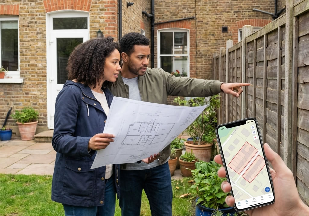
A RICS chartered surveyor conducting a boundary inspection at a residential property
GNSS RTK receiver being used in the field for boundary survey

Surveyor's theodolite on a tripod used for boundary measurements
RICS surveyor using a GNSS RTK rover in the field for centimetre-accurate boundary positioning
RICS surveyor walking a property boundary in the field with a handheld GPS device
RICS surveyor reviewing a boundary plan and report at a desk in the office