
Official HMLR Title Plan & Title Register
Order official Land Registry documents online: Title Plan, Title Register and historic title deeds, with T-marks and covenants, for any registered property in England and Wales. Sourced from HM Land Registry, emailed in minutes.
Title Plan £18.70 · Title Register £18.70 — Instant PDF by email
Order Official HMLR Title Documents
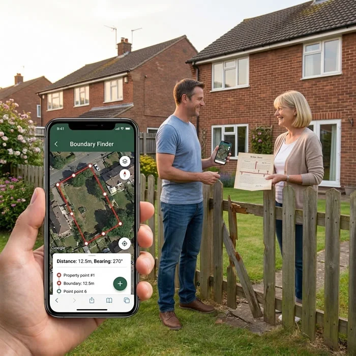
Under Section 60 of the Land Registration Act 2002, almost all registered property boundaries in England & Wales are general boundaries — not a fixed legal line. We help you locate and walk yours.
1Enter Your Postcode
Search your address — we automatically identify the HMLR title number linked to your Title Plan from the property preview page.
Enter Your Postcode →
2Select & Pay
Add the Title Register, Title Plan, or both on your property preview page — secure Stripe checkout.
Enter Your Postcode →
3PDF by Email
Official copies requested from HM Land Registry in real time and delivered to your inbox within minutes.
Delivery Times & FAQ →Watch: How to Get Official HMLR Title Documents & Historic Deeds
Trying to work out who owns the fence, or looking for old T-marks and original covenants? Watch how BoundaryFinder runs a live availability check with HM Land Registry, so you see exactly which documents are held — from the current Title Register and Title Plan through to historic Transfers, Conveyances and filed deeds — before you pay.
See how BoundaryFinder checks HM Land Registry for your official Title Register, Title Plan and historic documents — including T-marks and covenants — before you pay, with a full refund if nothing is found.
What Each Document Is
Title Register (OC1)
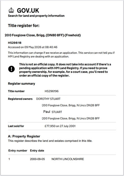
Three sections: A (Property), B (Proprietorship), C (Charges). Section B names the registered owner. Schedule 2 contains covenants. This is the document that answers: who owns it and what obligations run with the land?
Title Plan (OC1)
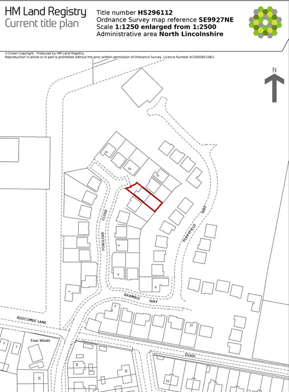
An official copy title plan of the filed plan at HM Land Registry. Shows the registered title extent with red edging on an OS base. Drawn to 1:1250 (urban) or 1:2500 (rural). Under s.60 LRA 2002 this shows the general boundary only — it does not fix the exact legal line.
Historic & Other Documents
Older filed documents held by HM Land Registry — including the Transfer (TP1/TR1), Conveyance, and other historic deeds. These are often the only place the original covenants and T-marks were ever recorded, where they are missing from the current Title Register and Title Plan.
Search your property →Historic Title Deeds, Conveyance & Transfer Deeds
Title Deeds and Land Registry Documents
Your title deeds are the documents that evidence ownership of your property. For registered property, HM Land Registry holds the current Title Register and Title Plan, and may also hold older filed documents. Not every original deed is held — many stay with the owner, their solicitor or their lender — so we run a live availability check before you pay.
Conveyance Deed and Transfer Deed
A conveyance deed is the older document that passed ownership of land, and a transfer deed (TP1/TR1) is its modern equivalent for registered land. Either can hold the original plan, the wording of fence covenants and any T-marks. Historic documents are available from £18.95 each where HM Land Registry still holds them, with a full refund if nothing is found.
Search your property →T-Marks on Your Title Plan
What T-Marks on a Title Plan Mean
A T-mark is a small “T” drawn on a boundary line to show which side a boundary covenant applies to, usually the side responsible for maintaining the fence or wall. The T-mark only locates the covenant; the wording in the deed creates the obligation. Responsibility to maintain a boundary is not the same as owning it.
Where to Find T-Marks
Most current Title Plans show no T-marks. They are more likely to appear on the plan in the original Transfer or Conveyance, so order the historic documents if your Title Plan and Register are silent. Where the documents are missing or disputed, physical fencing conventions can also be evidence.
Frequently Asked Questions
What is an HMLR Title Register?
The Title Register (OC1) is the definitive official record of a property held by HM Land Registry. It has three sections: A (Property Register — describes the estate and appurtenant rights), B (Proprietorship Register — names the registered owner and class of title), and C (Charges Register — lists mortgages, covenants and encumbrances). Section C Schedule 2 often contains boundary maintenance covenants stating which neighbour owns which fence. Admissible as evidence under s.67 LRA 2002.
What is an HMLR Title Plan?
The Title Plan is an official copy of the filed plan at HM Land Registry, drawn on an Ordnance Survey base map. It shows the registered title extent edged in red, at 1:1250 (urban) or 1:2500 (rural). Under s.60 LRA 2002, the Title Plan defines the general boundary only — it does not fix the exact legal boundary line. To check where the registered general boundary sits on the ground, combine the Title Plan with a GPS Boundary Report.
What is the difference between a Title Register and a Title Plan?
The Title Register is a text document showing ownership, tenure (freehold/leasehold), mortgages, covenants, and easements. The Title Plan is a map showing where the registered property sits geographically, with the boundary extent edged in red on an OS base. Most property, boundary, and conveyancing matters require both documents. Both are official copies (OC1) from HMLR, admissible as evidence under s.67 LRA 2002.
How long does it take to receive official HMLR documents?
Your title documents are delivered as PDFs to your email address within minutes of payment completing. BoundaryFinder requests the official copies from HM Land Registry in real time via the HMLR Business Gateway API — there is no postal wait and no account is required. A download link is also included on the payment confirmation page.
Are these genuine official copies from HM Land Registry?
Yes. Every Title Register and Title Plan is a genuine official copy sourced directly from HM Land Registry via the Business Gateway. The documents are identical to official copies obtained at GOV.UK and are admissible as evidence in court and at the First-tier Tribunal (Property Chamber) under s.67 LRA 2002. BoundaryFinder acts as your agent to retrieve these documents from HM Land Registry via the Business Gateway.
Can I use title documents in a boundary dispute?
Yes. The Title Register and Title Plan are the primary documentary evidence in any boundary dispute. The Title Plan shows the general registered extent; the Title Register Schedule 2 may contain covenants specifying boundary maintenance obligations. For the strongest evidence, combine title documents with a GPS Boundary Report and historical OS map evidence.
What is the OC1 form — do I need to complete one?
OC1 is the HMLR application form used to request official copies of the register entries and/or title plan for a registered property. When you order through BoundaryFinder, we submit an OC1 request on your behalf via the HMLR Business Gateway API. You do not need to complete any paperwork — the same official copy document is delivered instantly to your email.
How much does a Title Plan cost and can I order it on its own?
Yes — the Title Plan can be ordered on its own, without the Title Register. BoundaryFinder's official copy Title Plan costs £18.70. Enter your postcode above, confirm your title number, then select only the Title Plan at checkout. The PDF is delivered to your email within minutes.
Does the property need to be registered with HM Land Registry?
Yes. Title Registers and Title Plans only exist for properties registered with HM Land Registry. Approximately 90% of freehold land in England and Wales is now registered. Unregistered properties have no title register — ownership is instead evidenced by older title deeds. Enter your postcode above to confirm whether a title number can be found for your address.
What are T-marks on a title plan?
A T-mark is a small ‘T’ drawn on a boundary line on a plan to show which side the boundary covenant applies to, usually the side responsible for maintaining the fence or wall. The T-mark only locates the covenant; the wording in the deed creates the obligation. Most current Title Plans show no T marks, so the original Transfer or Conveyance is often where they are found. Responsibility to maintain a boundary is not the same as owning it. Where are my T-marks?
Can I get my title deeds from Land Registry?
For registered property, HM Land Registry holds the current Title Register and Title Plan, and may also hold older filed documents such as a Transfer (TP1/TR1) or Conveyance. It does not hold every original title deed, as many are kept by the owner, their solicitor or their lender. BoundaryFinder runs a live availability check before you pay, with a full refund if nothing is found.
What is a conveyance deed or transfer deed?
A conveyance deed is the older document that transferred ownership of land, and a transfer deed (TP1/TR1) is the modern equivalent for registered land. Either can contain the plan showing T-marks and the wording of fence covenants. Historic conveyance and transfer deeds can be ordered where HM Land Registry still holds them, from £18.95 per document.
What are Land Registry documents (HMLR documents)?
HMLR stands for HM Land Registry. Land Registry documents are the official records it holds for registered property: the Title Register (ownership, mortgages and covenants), the Title Plan (the registered extent on an Ordnance Survey map), and older filed documents such as Transfers and Conveyances. Official copies can be ordered for any registered property in England and Wales.
Do I need to own the property to order title documents?
No. Official copies of the Title Register and Title Plan can be requested for any registered property in England and Wales, whoever owns it. Enter the postcode, select the address and choose the documents you need.
Attribution & Legal Notice
Attribution: HMLR Title Registers and Title Plans are Crown copyright © HM Land Registry and are reproduced with permission. BoundaryFinder is not a law firm and this service does not constitute legal advice. For boundary disputes, consult a solicitor or licensed conveyancer. Terms & Conditions · Privacy Policy
Sample HMLR Title Register
Sample HMLR Title Plan
Enter Your Postcode
Select & Pay
PDF by Email