
General Boundary Data for Surveyors — PPK-Ready Coordinates & Instant Exports
Enter a postcode to get pre-processed HM Land Registry general boundary coordinates in minutes — ready for SW Maps, QGIS, AutoCAD, or your free OS Net PPK workflow. Use BoundaryFinder as your fast starting point before on-site RTK, laser scanning, or determined boundary work.
GPS Boundary Report — £24.95
General boundaries — HM Land Registry INSPIRE Index Polygons · Section 60, Land Registration Act 2002
General Boundary Data as Your Professional Starting Point
BoundaryFinder gives independent surveyors and contractors instant access to pre-processed HM Land Registry general boundary data — ready for SW Maps, QGIS, AutoCAD, and free OS Net PPK workflows. Use it as a fast, accurate reference layer before on-site RTK, laser scanning, or determined boundary applications.
Under Section 60 of the Land Registration Act 2002, almost all registered property boundaries in England & Wales are general boundaries. We help you locate and walk yours.
Who This Is For
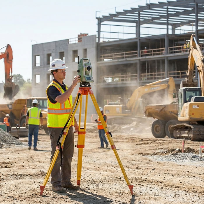
Independent surveyor with a low-cost GNSS rover — the BoundaryFinder workflow is built for this setup.
BoundaryFinder is designed for surveyors and contractors who want a fast, low-cost general boundary reference as a starting point — before committing to full measured surveys, RTK verification, or determined boundary work.
Independent & Small Firms
Quick boundary data without the overhead of raw INSPIRE bulk downloads or expensive data subscriptions
Contractors & Setting-Out
Pre-loaded coordinates for SW Maps or AutoCAD before you arrive on site — cut setup time significantly
Rural & Remote Surveys
Fully compatible with the free offline PPK workflow using OS Net RINEX — no mobile data needed in the field
Budget-Conscious Surveyors
No monthly subscription, no minimum commitment. Pay per report only — ideal for occasional or hobbyist use
Semi-Retired & Occasional
Keep doing accurate boundary work without expensive software subscriptions. Use free tools alongside BoundaryFinder data
Evidence & Pre-Survey Prep
Get the registered general boundary position before mobilising full kit — useful for dispute preparation and initial client briefings
How BoundaryFinder Saves You Time & Money

General boundary layer in QGIS — use as a reference alongside your own measured survey data.
Processing raw INSPIRE Index Polygon data yourself takes time — downloading bulk GML files, setting up PostGIS, writing queries, converting coordinate systems. BoundaryFinder does all of this for you and delivers the result in a format you can use immediately.
-
✓
Instant general boundary corner coordinates from official HM Land Registry INSPIRE data — no bulk data processing required
-
✓
Export formats you already use — GPX for SW Maps and OsmAnd, GeoJSON and CSV for QGIS and ArcGIS, DXF for AutoCAD and SketchUp
-
✓
Fully compatible with free PPK post-processing using OS Net RINEX data via Emlid Studio or RTKLIB — see the free guide
-
✓
Use as a reference layer — import alongside your own RTK GNSS measurements, laser scan data, or historical map overlays for comparison
-
✓
Historical maps and LiDAR terrain included — useful context for rural surveys, boundary disputes, and evidence gathering
-
✓
No subscription, no minimum order — pay per property report only, ideal for occasional or project-by-project use
Result: Spend less time on data preparation and more time on the skilled measurement and analysis work you charge for.
The Free Professional Workflow — Four Steps
From property search to corrected field coordinates, using only free tools and data alongside your BoundaryFinder report:
-
1Search the property and get your general boundary points.
Enter the postcode or address. BoundaryFinder retrieves the HM Land Registry INSPIRE polygon, extracts all boundary corner coordinates in both WGS84 and British National Grid, and makes them available for download immediately. -
2Export in the format you already use.
Download GPX for SW Maps or OsmAnd, GeoJSON or CSV for QGIS and ArcGIS, DXF for AutoCAD or SketchUp, or KMZ for Google Earth. All files are ready to import directly — no conversion step required. -
3Load as a reference layer and carry out your site work.
Import the general boundary layer into SW Maps, QGIS, or AutoCAD before you arrive on site. Use it as a starting reference alongside your own RTK GNSS, total station, or laser scan measurements. Log raw UBX data on your rover if you plan to post-process. -
4(Optional) Apply free PPK corrections using OS Net RINEX — no subscription.
Download the matching RINEX file from the free OS Data Hub for your survey time window, then post-process in Emlid Studio or RTKLIB to achieve 1–3 cm accuracy. Full details in the free RINEX & PPK Guide.
Export Formats Included With Every Report
Every BoundaryFinder GPS Boundary Report includes the full set of boundary corner coordinates in the formats listed below — plus terrain, elevation and building data:
All boundary corners as waypoints — navigate directly to each point in the field
WGS84 (EPSG:4326) — import as a reference layer into any GIS platform
British National Grid (EPSG:27700) — scaled in metres, no unit conversion needed
Easting, Northing, Latitude, Longitude per corner — compatible with any spatial tool
Boundary boundary polygon and corner points for visual reference and client communication
GPS boundary report + terrain & elevation profile + fence & boundary guide
Typical Surveyor Use Cases
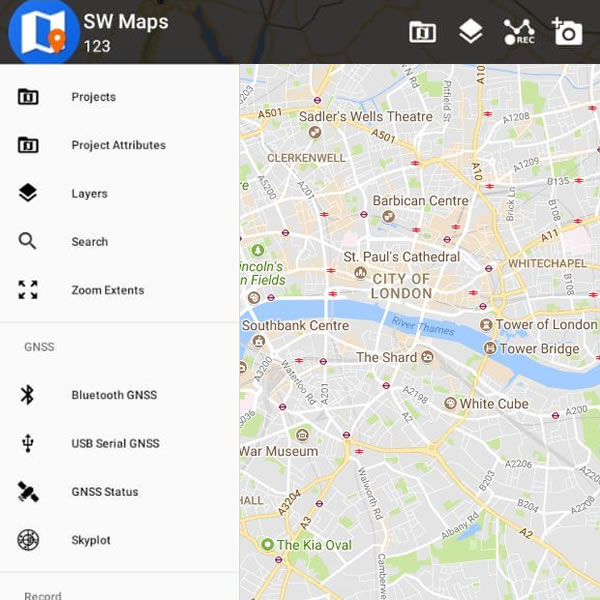
SW Maps with BoundaryFinder GPX points loaded — navigate to any boundary corner with one tap.
Preliminary checks before mobilising full kit
Get the registered boundary position before you book equipment, travel to site, or commission a full measured survey. Quickly confirm the extent of the area you need to cover.
Setting-out reference for contractors
Load the boundary corner coordinates into SW Maps or AutoCAD before you arrive. Use as a reference layer for pegging out, fencing, or construction setting-out work.
Rural and large-site initial mapping
For large agricultural or rural sites where walking the full boundary first is impractical, get a digital boundary layer you can overlay on satellite imagery or your own drone data before the detailed survey begins.
Evidence layer for boundary dispute preparation
Combine the registered general boundary position with historical OS maps, LiDAR terrain data, and your own RTK measurements as part of a boundary dispute evidence pack or formal determined boundary application.
Free PPK post-processing — no subscription
Log raw UBX data on your rover in SW Maps, download the matching OS Net RINEX file, and post-process in Emlid Studio for 1–3 cm accuracy — at no cost. See the free guide →
Client briefings and initial reports
Present the registered general boundary position to a client before the survey begins, using the PDF report and Google Earth KMZ overlay. Helps set expectations and scope the job accurately.
Realistic Expectations — What This Data Is and Is Not
BoundaryFinder provides data derived from HM Land Registry INSPIRE Index Polygons, which represent general boundaries under Section 60 of the Land Registration Act 2002. These are the same boundaries shown on HM Land Registry title plans — they show the approximate registered boundary position, not a legally determined line.
This data is an excellent starting point and reference layer. It is not a substitute for on-site measured surveys. For legal certainty, boundary disputes requiring formal determination, or engineering-grade accuracy, always combine with your own professional field measurements and, where required, a formal determined boundary application.
For background on the general boundary rule and what it means in practice, see General Boundaries Explained.
Ready to Get Started?
Search any UK property to get the registered general boundary coordinates — ready for your field software, CAD tools, and free PPK workflow.
Independent UK surveyor with a low-cost GNSS rover.
QGIS with HM Land Registry general boundary reference layer.
SW Maps with BoundaryFinder GPX boundary points loaded in the field.